KEY DOCUMENTS
MACHC Seabed 2030 Work Plan Status
MACHC-IOCARIBE Seabed 2030 Strategy
Seabed 2030 Survey
Seabed 2030 POC List
Seabed 2030 - MACHC 2019 Story Map
MACHC/DCDB Letter
Regional Seabed 2030 Coordinator Role
Crowdsourced Bathymetry
IHO Crowdsourced Bathymetry Background
Guidance on Crowdsourced Bathymetry
IHO CL 21/2020
IRCC CL 01/2020
OTHER INFORMATION
Seabed 2030 Roadmap
Seabed 2030 Video
What needs to be mapped?
SEABED 2030
MACHC Region
SEABED 2030 in the MACHC region is organized in four project pillars: 1) Data Discovery, 2) Data Sharing, 3) Finding and Filling Data Gaps, and 4) Close Coordination between the MACHC, Seabed 2030 Regional Data Assembly and Coordination Center for the Atlantic and Indian Oceans and Other Regional Stakeholders. There are three Goals that have been defined in the Seabed 2030 Work Plan
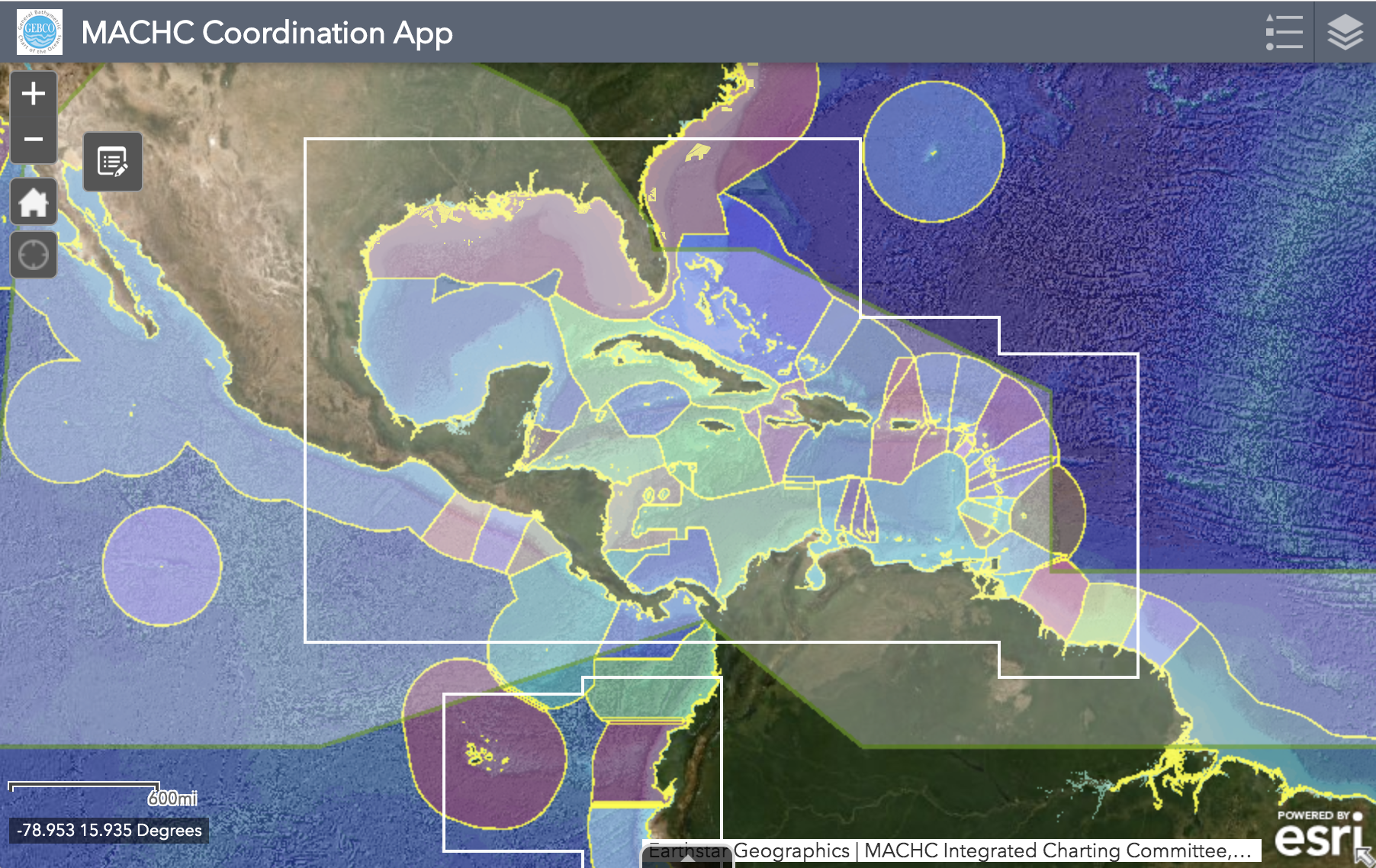
 CLICK IMAGE to view the MACHC-Seabed 2030 WebApp
The MACHC-Seabed 2030 WebApp was developed collaboratively with the Seabed 2030 Regional Data Center for the Atlantic and Indian Oceans to foster communication and coordination among stakeholders within the MACHC region. The WebApp presents several layers of information relating to the most recent GEBCO bathymetry products, existing data in the region, and upcoming mapping efforts.
Links:
CONTRIBUTE DATA TO DCDB
NOAA Data Sharing Agreement Template
International Bathymetric Chart of the Caribbean Sea and the Gulf(IBCCA)
Seabed 2030 Centers
Contact the Atlantic and Indian Oceans Regional Center
Explore Data Holdings at the Centre for Digital Bathymetry (DCDB)
The Nippon Foundation-GEBCO Seabed 2030 Project
Other Seabed 2030 Links (Articles, Videos, National Mapping Coordination Efforts)


